|
导师介绍
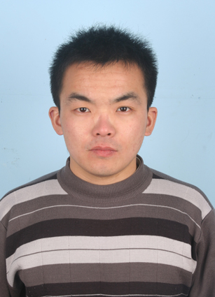
靳华安
个人简介: 靳华安,男,1984年生,汉族,山东泰安人,博士,副研究员,硕士生导师 招生专业: 地图学与地理信息系统 学习与工作经历: 2011.07-至今,中国科学院成都山地灾害与环境研究所,数字山地与遥感应用中心,助理研究员、副研究员 2022.09-2023.09,法国图卢兹第三大学/生物圈空间研究中心(CESBIO),访问学者 2008.09-2011.07,北京师范大学,地理科学学部,博士 2005.09-2008.07,中国科学院东北地理与农业生态研究所,硕士 2001.09-2005.07,聊城大学,环境与规划学院,学士 研究方向: 主要从事植被定量遥感、生态遥感研究,重点围绕典型生态参量开展遥感反演理论与方法创新、以及遥感监测应用研究。近期研究兴趣聚焦于:(1)融合深度学习的生态参量遥感智能反演与动态监测;(2)植被参数遥感反演与数据同化;(3)长时间序列遥感产品应用分析;(4)植被对气候变化与人类活动的响应与反馈。 主持科研项目: 国家自然科学基金面上项目“顾及地形效应和植被结构表达的山地叶面积指数遥感反演”,2026-2029; 西藏自治区重点研发计划项目“西藏草地植被绿度-光合效率-生产力时空动态不一致性遥感表征”,2026-2027; 四川省中央引导地方科技发展专项项目“若尔盖草地覆盖-绿度-生产力时空动态及其对气候变化的响应”,2024-2026; 四川省自然科学基金面上项目“川西北生态示范区气候变化对植被生产力的影响及评估”,2024-2025; 国家重点研发计划子课题“山地关键参数通用快速反演算法构建与验证”,2021-2025; 国家自然科学基金面上项目“基于深度学习的不同空间尺度时间序列叶面积指数遥感反演”,2021-2024; 中国科学院西部青年学者项目“四川省高分辨率叶面积指数遥感反演及产品生产”,2021-2023; 国家自然科学基金重点项目课题“山地典型生态参量反演建模及数据同化方法”,2017-2021; 国家自然科学基金面上项目“复杂地形区多尺度叶面积指数遥感估算方法研究”,2017-2020; 国家自然科学基金青年项目“山区森林时间序列叶面积指数遥感反演及地形效应分析”,2014-2016。 社会任职、荣誉称号: 中国科学院“西部青年学者”、SCI期刊“Chinese Geographical Science”青年编委、国际数字地球学会中国国家委员会数字山地专业委员会委员、中国遥感应用协会定量遥感专业委员会青年委员、遥感科学研究生沙龙优秀指导教师、中国农业工程学会优秀论文奖、山地所先进工作者。 学生培养: 培养学生获得多次国家奖学金、国科大三好学生、山地所首届优秀研究生奖学金、优秀研究生报告等荣誉; 多名毕业生跻身选调生、省直事业单位及国有企业。 代表性论文: Jin, H., Qiao, Y., Liu, T., Xie, X., Fang, H., Guo, Q., Zhao, W. (2024). A hierarchical downscaling scheme for generating fine-resolution leaf area index with multisource and multiscale observations via deep learning. International Journal of Applied Earth Observation and Geoinformation, 133, 104152. Zhang, X., Jin, H.*, Zhao, W., Yin, G., Xie, X., Fan, J. (2025). Assessment of satellite-derived FAPAR products with different spatial resolutions for gross primary productivity estimation. IEEE Journal of Selected Topics in Applied Earth Observations and Remote Sensing, 18, 3087-3098. Liu, Z., An, R., Qiao, Y., Ma, X., Gao, L., Jin, H.* (2025). Estimation of leaf area index using radiative transfer process-guided deep learning. IEEE Geoscience and Remote Sensing Letters, 22, 2500705. An, R., Jin, H.*, Zhao, H., Wei, D., Zhao, W., Wang, X. (2024). Productivity experienced a more rapid enhancement trend than greenness across the Tibetan Plateau. Science of the Total Environment, 954, 176666. Jin, H., Li, A., Liang, S., Ma, H., Xie, X., Liu, T., He, T. (2022). Generating high spatial resolution GLASS FAPAR product from Landsat images. Science of Remote Sensing, 6, 100060. Liu, T., Jin, H.*, Xie, X., Fang, H., Wei, D., Li, A. (2022). Bi-LSTM model for time series leaf area index estimation using multiple satellite products. IEEE Geoscience and Remote Sensing Letters, 19, 2506805. Zhang, W., Jin, H.*, Li, A., Shao, H., Xie, X., Lei, G., Nan, X., Hu, G., Fan, W. (2022). Comprehensive assessment of performances of long time series LAI, FVC and GPP products over mountainous areas: A case study in the Three-River Source region, China. Remote Sensing, 14, 61. Jin, H., Li, A., Xu, W., Xiao, Z., Jiang, J., Xue, H. (2019). Evaluation of topographic effects on multiscale leaf area index estimation using remotely sensed observations from multiple sensors. ISPRS Journal of Photogrammetry and Remote Sensing, 154, 176-188. Jin, H., Li, A., Yin, G., Xiao, Z., Bian, J., Nan, X., Jing, J. (2019). A multiscale assimilation approach to improve fine resolution leaf area index dynamics. IEEE Transactions on Geoscience and Remote Sensing, 57(10), 1-16. Jin, H., Li, A., Bian, J., Nan, X., Zhao, W., Zhang, Z., Yin, G. (2017). Intercomparison and validation of MODIS and GLASS leaf area index (LAI) products over mountain areas: A case study in southwestern China. International Journal of Applied Earth Observation and Geoinformation, 55, 52-67. Jin, H., Li, A., Wang, J., Bo, Y. (2016). Improvement of spatially and temporally continuous crop leaf area index by integration of CERES-Maize model and MODIS data. European Journal of Agronomy, 78, 1-12. 联系方式: 通讯方式:610213,成都市天府新区群贤南街189号,中国科学院水利部成都山地灾害与环境研究所 Email: jinhuaan@imde.ac.cn
|
| 版权所有:中国科学院、水利部成都山地灾害与环境研究所 蜀ICP备05003828号川公网安备 51010702001669号 地址:四川省成都市天府新区群贤南街189号 邮编:610213 | 联系我们 |